Touch the sky with weather built for aviators
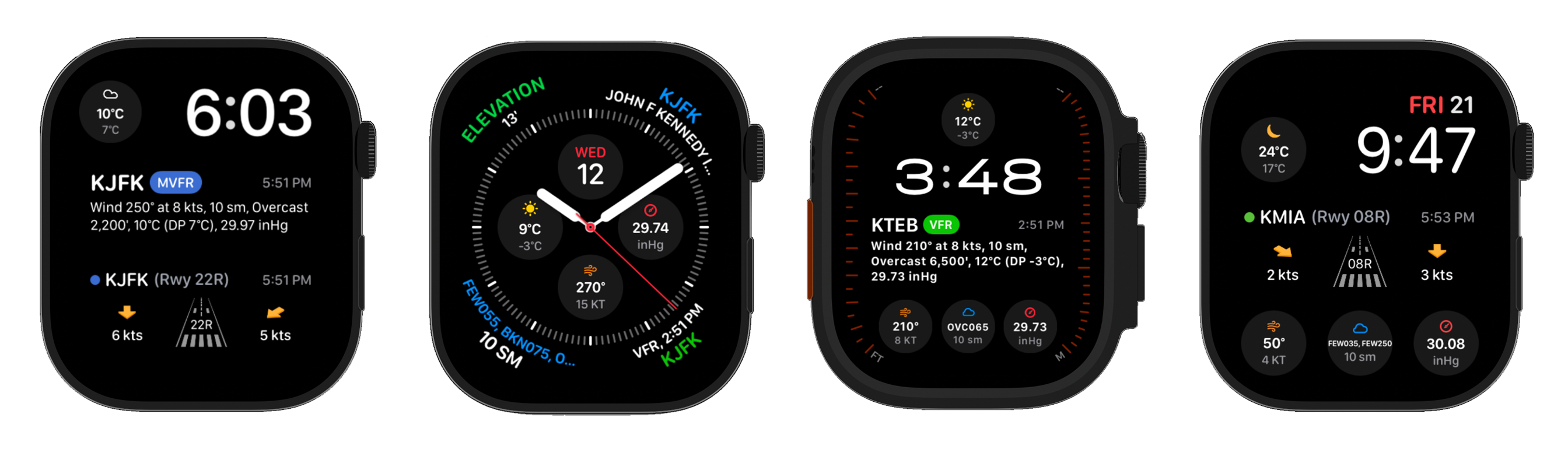
Complication library

METAR Pilot keeps you ahead of every ceiling shift, crosswind, and pressure drop. A cinematic interface inspired by glass cockpits delivers clarity whether you're dispatching an IFR route or planning a weekend hop.

- Airports tracked
- 5,000+
- Updates / day
- 96 Refreshes
- Watch face
- 10+ Complications
- Countries covered
- 250+
ENCODED METAR Report
KJFK 202351Z 20008KT 10SM FEW200 SCT250 01/M06 A3014 RMK AO2 SLP207 T00111056 10033 20006 $
Observation Time
2351Z · 6:51 PM EST
Flight Category
VFRHigh Clouds Only · Unlimited Ceiling
Wind
200° at 8 kts
Light Crosswind · Runway 22R within limits
Visibility
10 sm
No Restrictions
Ceiling
FEW 20,000 ft
Scattered Layer at 25,000 ft
Temp · Dew Point
1°C / -6°C
Spread 7°C · Dry, No Fog Risk
Altimeter
30.14 inHg
QNH 1021 hPa
Remarks
Precise Temp 1.1°C / −0.6°C
Automated Station · Equipment Needs Attention
*This is a demo data example - do not use for real-world navigation or flight planning.
Pilot logbook Free
You flew it. Now it’s already written down.
METAR Pilot keeps the record too — a full digital logbook on the web, free for every pilot, that the iPhone app fills in from the flight you just flew.
- Free on the web. Every column off the Jeppesen form, no plan or card.
- Captured automatically. Route, times and ground track waiting at shutdown.
- Import from ForeFlight. Run the same file twice — nothing doubles up.
- Prints to certify. Jeppesen-style PDF with totals and a signature line.
| Date | Aircraft | Route | Ldg | PIC | Total |
|---|---|---|---|---|---|
| 07‑19 | N4172J | KPAO › KMRY | 2 | 1.6 | 1.6 |
| 07‑14 | N738KL | KSQL › KSQL | 6 | 0.0 | 1.2 |
| 07‑09 | N4172J | KPAO › KSAC | 1 | 2.1 | 2.1 |
| 07‑02Draft | N221AT | KHAF › KPAO | 1 | 0.8 | 0.8 |
| Total to date | 486 | 289.5 | 391.6 | ||
Free forever · No card · Export any time
Atmospheric intelligence
Designed to feel like a glass cockpit
Every interaction carries aviation DNA—bold typography, clear contrasts, and precise iconography that mirror the clarity of a glass display.
Instant METAR Access
Get real-time weather reports from thousands of airports worldwide using their ICAO codes. Access temperature, dew point, wind speed/direction, visibility, cloud layers, and altimeter settings.
Trusted flight data
Location Based Weather
Automatically discover nearby airports and their current weather conditions. Set your home airport for quick access to frequently needed weather data.
Trusted flight data
Flight Categories
Instantly see VFR, MVFR, IFR, or LIFR conditions with color-coded indicators. Get wind component analysis to help select optimal runways.
Trusted flight data
Smart Airport Search
Find airports quickly by name, city, or ICAO code with intelligent search suggestions. Access comprehensive weather data for flight planning.
Trusted flight data
Weather at a Glance,
Anywhere on Apple Devices
Keep METAR data pinned to your home screen, lock screen, and desktop. Updates flow automatically, with a manual refresh when you need a fresh report before takeoff.
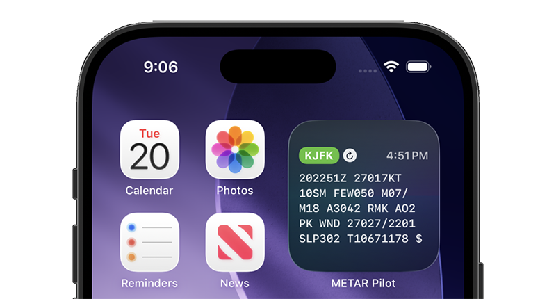
Home Screen Widget
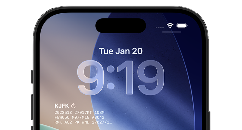
Lock Screen Widget
iOS & macOS Widgets
Add METAR Pilot widgets to your iPhone home screen, lock screen, or macOS desktop for quick, readable METAR data.
Automatic Updates
All widgets refresh every 15 minutes with METAR updates, keeping temperature, wind, visibility, and altimeter data current without opening the app.
Flexible Airport Selection Modes
Pick nearby, home, or custom airports so all widgets follow the weather source you need, whether you're traveling or tracking a base field.
Instant Manual Refresh on Demand
Tap the refresh icon to pull the latest METAR instantly for preflight checks or rapidly changing conditions.
Know Your Wind Components
Before You Even Reach the Runway
The Best Wind complication puts critical Runway wind data right on your Apple Watch face. See headwind and crosswind components at a glance - no more mental math, no more guessing.
Best Wind complication in action
Automatic Best Runway Selection
Let the app pick the optimal Runway with the most favorable wind conditions - or lock in your assigned Runway with a single tap.
Headwind Component
Know exactly how much wind is working with you - shortening takeoff rolls and helping you nail those smooth touchdowns.
Crosswind Component
Instantly see if the crosswind is within your limits. Left or right, with clear visual arrows showing direction and intensity.
Runway Selector with Lock
Tap to browse all runways with dimensions and surface info. Lock your preferred runway and monitor its wind components until you switch.
Flight timeline
A companion for every phase of flight
Tap into immersive cards that mirror the cadence of a mission briefing. Swipe through preflight to arrival with tactile vibration cues on Apple Watch and rich detail on iPhone.
Preflight
Brief & File
Decode METARs, view TAF trends, and mark alternate airports before you leave the ground.
Taxi & Takeoff
Situational Awareness
Live wind component analysis helps you pick the right runway and stay within crosswind limits.
En Route
Stay Ahead of Weather
Monitor diversions and reroutes with at-a-glance visibility, ceilings, and pressure changes.
Arrival
Smooth Approaches
Instantly switch to destination airports and share decoded weather with your crew or students.
From map to forecast
The whole briefing, before you leave the ramp
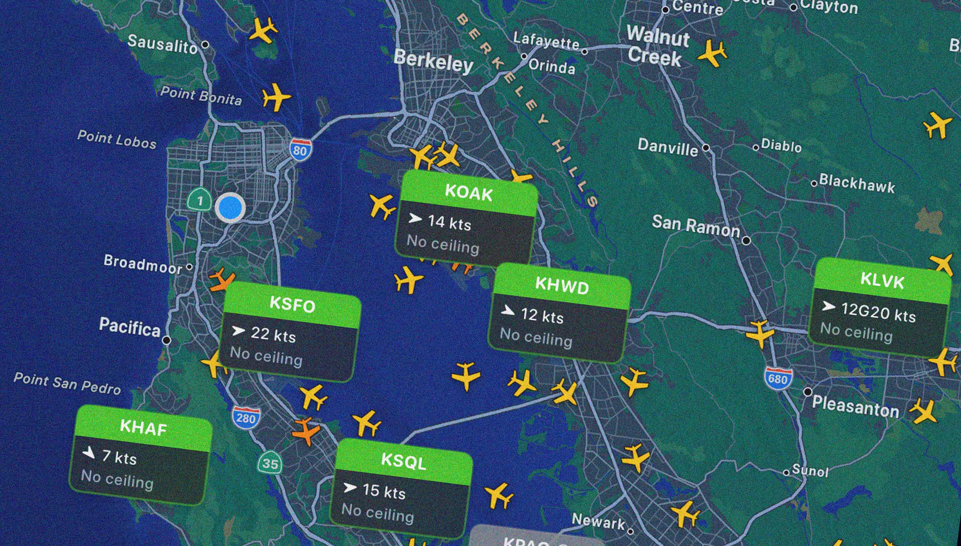
See flight conditions at every field around you, with live traffic overhead. Tap an airport for the full picture: current conditions in plain English, days of reports charted, and the forecast checked against your personal minimums.
Map
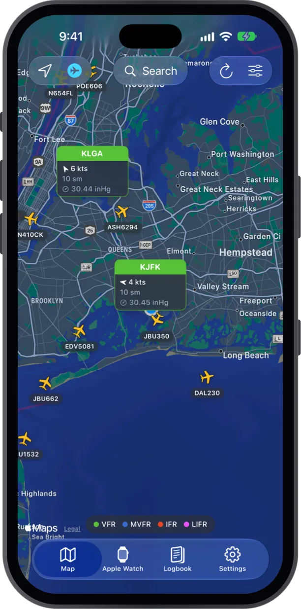
Every field, color-coded
Flight category, wind, visibility and altimeter at every nearby field, with live traffic overhead.
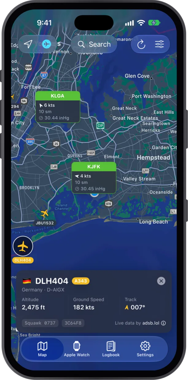
Tap any aircraft
Callsign, type, registration, altitude, ground speed, track and squawk, from live ADS-B data.
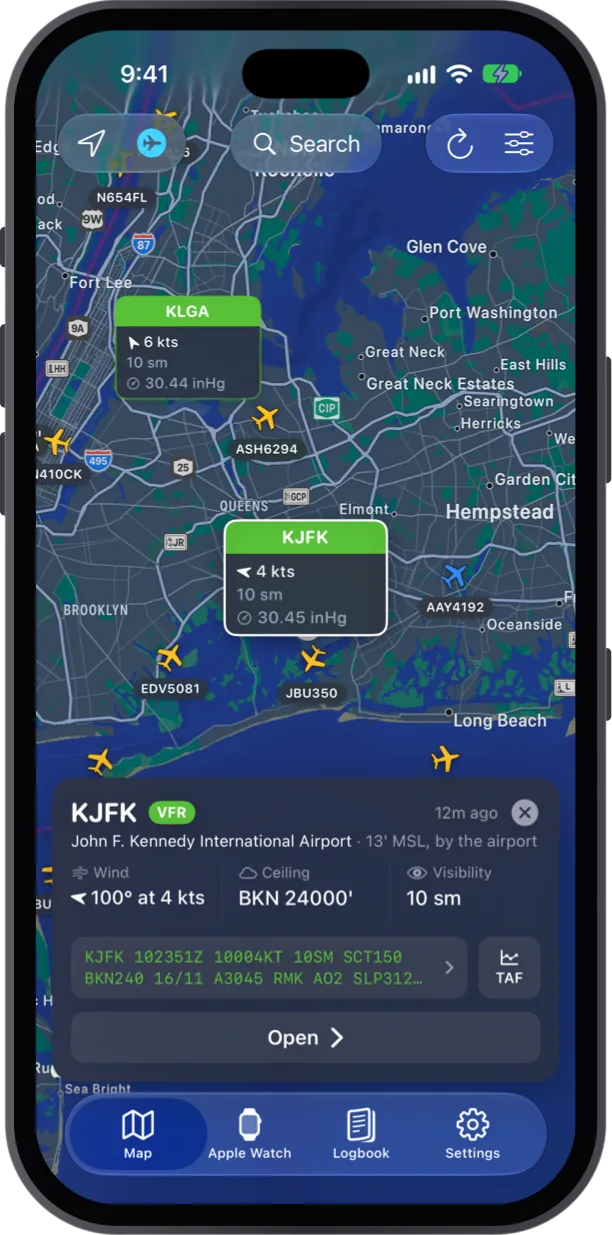
Tap any airport
Wind, ceiling, visibility and the raw METAR in one card, a tap away from the TAF or the full report.
Airport
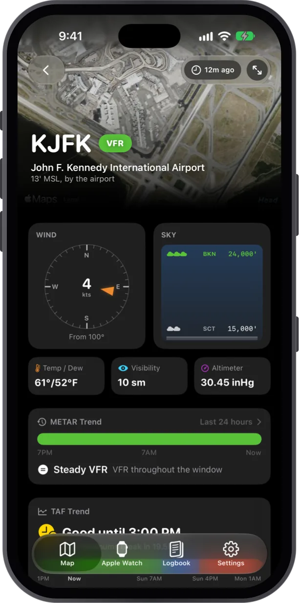
The airport at a glance
A wind compass and cloud layers over a satellite view of the field, with temperature, visibility and altimeter below.
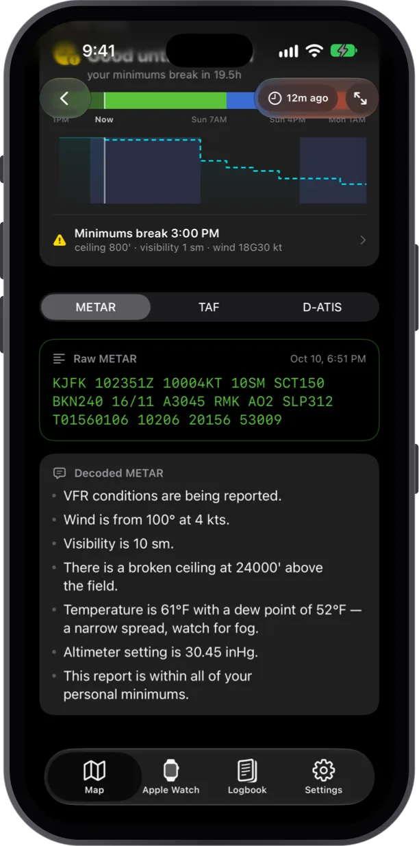
METAR in plain English
Every report spelled out line by line, with a fog watch when the spread narrows and a check against your minimums.
History
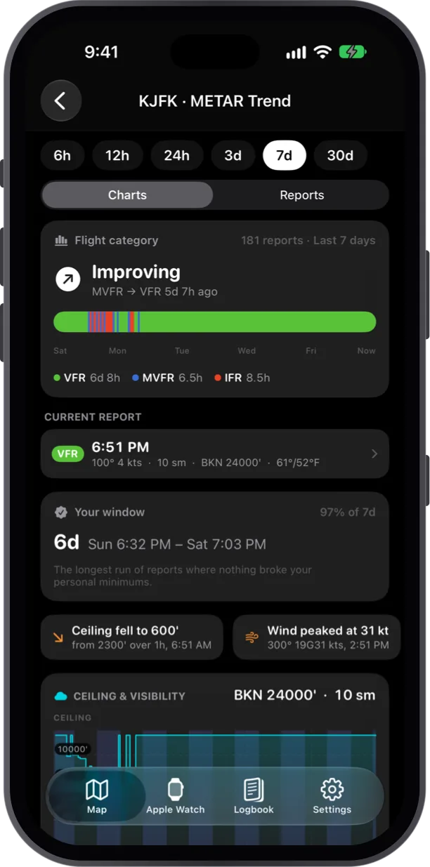
METAR Trend
Up to 30 days of reports: time in each flight category, the biggest swings, and your longest window inside minimums.
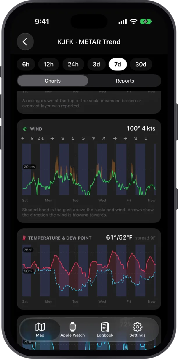
Every reading, charted
Ceiling, visibility, wind and gusts, temperature and dew point, plotted across the range you pick.
Forecast
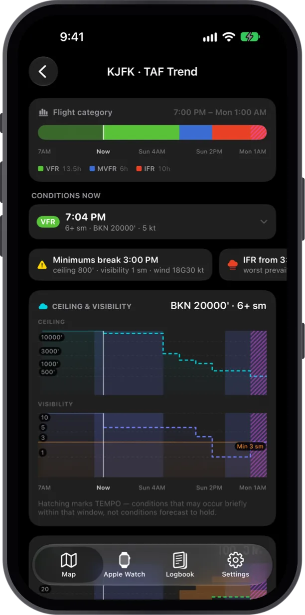
TAF Trend
The forecast laid out as a timeline, with the hour it breaks your personal minimums called out.
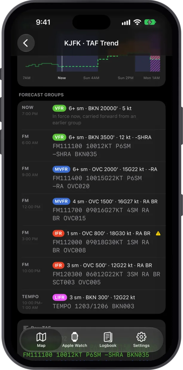
Every forecast group
Each FM and TEMPO period with its flight category, decoded in a line above the raw TAF text.
Simple pricing
Choose the right co-pilot for your mission
Get started for free with 2 days of unlimited access. Our plans adapt to your flying schedule and sync instantly across devices.
2 Days Free
$02 days
Test ride with no limits!
Full functionality for a trial period.
- Unlimited Airports Worldwide
- Unlimited Apple Watch Complications
- Extended Search Radius
- Beautiful Dark Mode
1 Month
Starts from*$1.99per month
Full access to all premium features for one month.
- Unlimited Airports Worldwide
- Unlimited Apple Watch Complications
- Extended Search Radius
- Advanced Weather Analysis
- Priority Data Updates
- Beautiful Dark Mode
3 Months
Starts from*$3.99per 3 months
Save 33%
Best value for seasonal pilots. Save compared to monthly.
- Unlimited Airports Worldwide
- Unlimited Apple Watch Complications
- Extended Search Radius
- Advanced Weather Analysis
- Flight Planning Assistance
- Priority Data Updates
- Priority support
1 Year
Starts from*$9.99per year
Save 60%
Maximum savings for committed pilots. Best deal!
- Unlimited airports worldwide
- Unlimited Apple Watch complications
- Extended search radius
- Advanced weather analysis
- Flight planning assistance
- Priority data updates
- Ad-free experience
- Priority support
* All prices are displayed in USD. Actual pricing in the App Store may vary by country, currency, and taxes. Prices are subject to change without notice.
Pilots trust
Built with input from airline captains, CFIs, and private pilots
Whether you fly heavies, taildraggers, or sim rigs, METAR Pilot delivers the same crystal clarity across every device.
Professional Pilots
Rapid weather briefings, reliable crosswind math, and quick runway visual cues for commercial operations.
Student Pilots & CFIs
Decode METARs together, annotate conditions, and reinforce weather concepts in real flights or classroom sessions.
Enthusiasts & Spotters
Follow global airports, track storms, and share animated weather cards instantly.
Dispatch & Ops Teams
Sync teams on the same source of truth with shareable links and precise timestamps.